Infrastructure projects are among the most complex things humans build. A highway interchange. A metro tunnel. A water treatment plant. A stadium. These are not built in any sequence a single observer can follow — they are systems of systems, built simultaneously across multiple fronts, over years, by hundreds of people who mostly never overlap.
And yet everyone involved — funders, regulators, communities — wants to understand what is happening. When is the road opening? Is the project on track? These are not unreasonable questions. They are just questions that written reports, progress photographs, and milestone meetings answer very poorly.
This is where construction timelapse and advanced visual capture technology have changed the conversation. Not just for the post-project highlights reel, but as a live tool for managing, communicating, and defending the decisions made on complex infrastructure projects.
This guide covers how modern infrastructure projects use visual technology throughout the project lifecycle, and why the organisations that get this right treat visual documentation as infrastructure in its own right.
Why Infrastructure Projects Are Different — And Why Standard Documentation Fails Them
A residential building project has a clear visual narrative. The footings go in. The frame goes up. The façade follows. A non-specialist can look at a progress photograph and understand roughly where the project is.
Infrastructure projects do not work this way. A highway bypass looks, in a progress photograph, like a muddy field with machinery scattered across it. A metro line looks like excavations in different streets with no visible connection. A water treatment facility looks like tanks and pipes with no obvious indication of what any of it does or how close it is to operational.
This visual opacity creates real problems. Funders struggle to assess whether the project is genuinely on track. Communities cannot understand what stage the disruption is at. And project teams trying to explain delays need to show — not just describe — what was happening on site when the programme shifted. Construction timelapse addresses all of these problems simultaneously, by turning months of complex parallel activity into a sequence that any audience can follow.
The failure mode of traditional documentation on infrastructure projects is not inaccuracy — it is illegibility. The data exists. The reports exist. The photographs exist. Nobody can read them in a way that produces genuine understanding of the project’s status.
What Advanced Visual Capture Actually Means on an Infrastructure Project
Visual capture on a modern infrastructure project is not a single system. It is a layered approach using different technologies for different purposes — and understanding what each layer does is the starting point for specifying it correctly.
Time-lapse photography is the foundational layer. A construction timelapse system on an infrastructure project typically involves multiple fixed cameras positioned to cover the primary construction fronts, capturing images at regular intervals — every one to five minutes during active working hours — and compiling them into footage that makes the pace and sequence of complex work visible.
Drone survey is the elevated perspective layer. Where fixed cameras provide continuous records of specific zones, drone surveys provide periodic comprehensive coverage of the entire project footprint. A monthly drone survey produces high-resolution imagery that can be compared over time and incorporated into stakeholder reports in a way that fixed camera footage cannot match for scale.
Live streaming and remote viewing are the communication layer. The ability to view the site remotely at any time is politically and operationally valuable for major projects with multiple stakeholder groups. A project director can show live site footage to a parliamentary committee. A community group can see that the work phase near their neighbourhood has moved on.
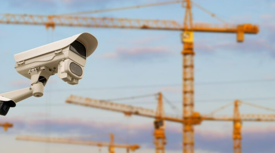
Security monitoring is the protective layer. Video Recording and CCTV Recording for infrastructure projects addresses a specific challenge: these are large, often poorly-lit, multi-access sites with significant material value on them at all times. Integrated Construction Site Security Cameras & CCTV systems that combine perimeter monitoring, access control recording, and time-lapse documentation from shared infrastructure reduce total system cost while providing both the documentary and the protective function.
The Specific Value of Construction Timelapse on Infrastructure Projects
On a straightforward building project, construction timelapse produces a satisfying visual narrative almost automatically. On an infrastructure project, the footage needs to be positioned, curated, and deployed with intent.
Progress communication to non-technical stakeholders is where infrastructure time-lapse earns its keep most clearly. A transport agency client can be shown footage of the last three months of activity on each construction front. Progress percentages and programme charts become a visible record of work completed.
Delay and variation documentation is where time lapse building construction footage proves its legal and commercial value. Infrastructure projects almost always involve claims for delay, additional work, or changed conditions. Footage showing site access blocked for three weeks is more compelling than a site diary entry saying the same thing.
Community and public engagement is an increasingly important use case. A time-lapse portal allowing residents to see current site footage and understand where specific work phases are relative to their neighbourhood addresses a communication need that a monthly newsletter cannot.
Institutional knowledge retention is the use case that most projects discover after the fact. Time lapse building construction footage captures not just the sequence of work but the context of decisions — where equipment was positioned, how traffic was managed, where ground conditions created unexpected challenges.
Building Timelapse at Scale: What Infrastructure Projects Require That Building Projects Do Not
A building timelapse system for a single structure — one site, one primary construction sequence — is a well-understood specification. An infrastructure project adds several layers of complexity that require a different approach.
Geographic extent. A highway project might extend over tens of kilometres. Fixed cameras need to be positioned strategically at key activity zones rather than comprehensively across the entire footprint. The selection of those zones requires understanding which parts of the project are most complex, most contentious, or most likely to be the subject of future disputes.
Multiple simultaneous fronts. Infrastructure projects do not build linearly from one end to the other. Multiple work fronts progress in parallel, each with different trades, different subcontractors, and different programme implications. A visual capture strategy needs to cover each active front to allow independent progress tracking and independent evidence collection.
Duration and conditions. Infrastructure projects run for years, not months. Camera systems need to operate reliably through seasonal weather variation, site changes, and construction activity that may temporarily obstruct lines of sight.
Data management at scale. A building timelapse on a single structure over twelve months produces terabytes of data. An infrastructure project with multiple cameras over several years produces orders of magnitude more. Storage architecture, access protocols, and retention policies need to be specified as part of the project infrastructure — not as an afterthought when the hard drives are full.
How Visual Documentation Is Being Used Before, During, and After Infrastructure Projects
The most sophisticated infrastructure organisations treat visual documentation as a continuous process — starting before the first machine moves and ending years after the last contractor leaves.
Pre-construction baseline recording is the foundation. Before any work begins, a comprehensive visual record of the existing conditions — drone survey, fixed camera baselines, street-level photography of adjacent structures — establishes what existed before the project started. Without it, every claim of project-caused damage becomes an argument. Aconstruction timelapse system starting from day one of site establishment captures this baseline automatically.
During construction, visual documentation is both a management tool and an evidence archive. Project managers track actual versus planned progress. Incidents are investigated using camera records that reduce argument about what happened to a review of footage.
Post-construction, the visual archive becomes a maintenance and operational asset. Maintenance organisations that were not involved in the original construction can use the time-lapse archive, combined with as-built drawings, to understand the construction sequence, the decisions made during build, and the locations of concealed elements relevant to future maintenance.
The Questions That Determine Whether a Visual Capture Programme Succeeds
The difference between a visual capture programme that delivers genuine value and one that produces footage nobody uses comes down to the questions asked before the cameras go up. For a construction timelapse programme on an infrastructure project, these are the questions that matter most.
Who are the audiences and what do they need to see? A government client needs progress against programme. A community group needs to see specific work phases. A legal team needs timestamped footage. A maintenance organisation needs footage by infrastructure element. These are different needs that may require different camera positions and access arrangements.
What are the high-risk zones for disputes and claims? The interfaces between work packages, the sections running through communities, the phases most susceptible to weather and ground condition delays, the access points shared between multiple contractors — these are the zones where camera coverage needs to be most comprehensive and most reliable.
How will the footage be accessed and used during the project? Footage reviewed regularly and integrated into management routines produces far more operational value than footage captured and left until a dispute arises.
What is the handover and retention plan? The visual archive should transfer with the asset, with clear metadata, organised storage, and a defined retention period that accounts for the long operational life of infrastructure assets.
The Infrastructure Project That Did Not Bother Is the One You Read About Later
Infrastructure projects with comprehensive visual documentation programmes do not make the news. The delays and disputes are resolved more quickly, the community communication is smoother, and the institutional knowledge is retained rather than lost.
construction timelapse system was deferred to save cost, where the cameras covered the wrong zones, where the footage was not retained past the point it was needed.
Visual capture on a major infrastructure project is a rounding error in the context of a multi-hundred-million contract. What it provides in return — evidence, accountability, communication, and institutional memory — is worth orders of magnitude more than what it costs.
Commission it properly. Position it deliberately. Use it actively. Keep it permanently.
The Questions Underneath the Questions
What infrastructure project managers and clients actually ask. And what usually goes unspoken behind each question.
We have drone surveys already. Do we still need fixed time-lapse cameras?
Drone surveys and fixed time-lapse cameras do different things, and you need both. A drone survey gives a comprehensive snapshot of the entire project footprint, typically monthly or quarterly. A fixed time-lapse camera gives a continuous record of specific zones every few minutes, every working day. The drone tells you what the site looked like on twelve days in a year. The fixed camera tells you what happened every day in between.
Our project runs across multiple local authorities and regulatory bodies. Can a single visual capture system serve all of them?
A single integrated system can serve multiple regulatory and stakeholder audiences, but outputs need to be configured for each. Different authorities need different access levels, retention periods, and reporting formats. This is easier to configure at the outset than to retrofit once the project is live.
How do we handle camera repositioning as the project progresses and the site changes?
Camera repositioning is a normal part of managing time-lapse on a long infrastructure project. The key is maintaining continuity of coverage for zones that carry the highest evidence and management value. A camera management plan tied to project phases is a standard part of a professional time-lapse specification for infrastructure projects.
What happens to the footage when the project delivery organisation hands over to the operating organisation?
The visual archive should be treated as a project deliverable in the same category as as-built drawings and operational manuals — formally handed over, with an organised file structure, complete metadata, and a defined retention period. For infrastructure assets with operational lives of thirty to fifty years, a minimum of ten years retention is reasonable.
Is there a risk that time-lapse footage could be used against us in a claim rather than supporting our position?
Yes, footage can reveal inconvenient things. The answer is not to avoid time-lapse — it is to run the project in a way that produces footage you are comfortable with. The organisations most uncomfortable with time-lapse are the ones with most reason to be. The ones that run good projects benefit disproportionately from having a complete visual record.
How do we deal with privacy concerns on infrastructure projects that run through residential areas?
Privacy considerations are real but manageable. Fixed cameras focused on the construction zone rather than residential properties are generally permissible under standard data protection frameworks, provided appropriate notices are posted at the site boundary. A professional provider should be able to produce a privacy impact assessment as part of the commissioning package.
What is the realistic budget for a comprehensive visual capture programme on a major infrastructure project?
It varies by project extent, camera count, and curation required. A comprehensive programme typically represents between 0.05% and 0.15% of total project value. The more useful comparison is the cost relative to a single unresolved claim — which typically costs more than the entire visual capture programme.